We wanted to do a long distance cycle tour, with the least need of flying in between, the easiest in terms of paperwork (visas, etc.) and, since we will be travelling as a family, where we could get the most of interacting with the people we meet along the way.
Some “classic” long distance tours, apart from going around the world, are:
- Europe to East Asia: extremely hard in terms of getting the right visas at the right time, many different languages along the way, some countries along the way might not accept foreigners or are just unsafe with kids
- Africa north to south: should be easy to navigate with just French and English, but still there are many borders to cross, loads of paperwork, nasty diseases due to hot climates, and big and dangerous animals
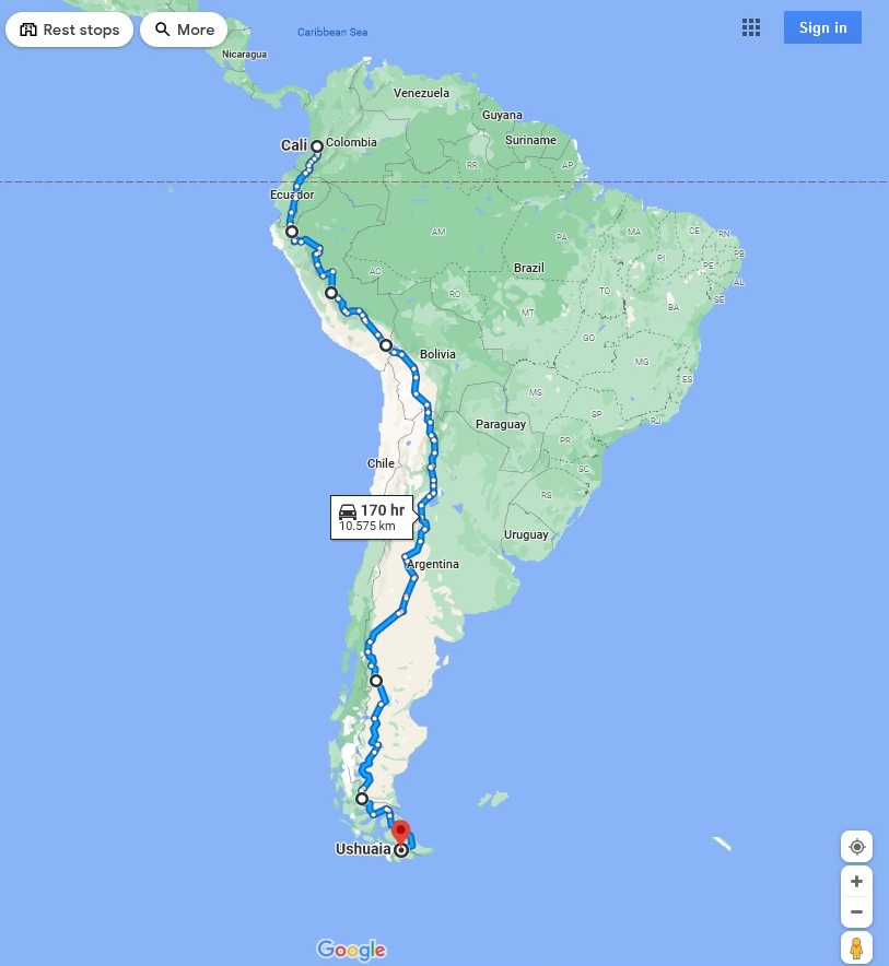
- Panamericana: many borders, but most easy to cross for Europeans. With Spanish and English you can go anywhere. Big mountains along the way, but with options to avoid the hardest parts. Only the border between Panama and Colombia does not have road connection, and a private boat or a flight is required.
Given those points, the choice of the Panamericana was easy. We are both Europeans, fluent in Spanish and English, and flights from Frankfurt to anywhere are easy to find.
How to do the Panamericana by bike?
Most people cycling the Panamericana start either in Alaska (north) or Ushuaia (south) and cycle to reach the other extreme. This trip takes about 18 months and about 20,000 km, to do it at a realistic pace and catching the best seasons on each country.
We wanted to do it north to south as it is generally recommended to get the winds mostly in your favour. Our initial plan was to start in Vancouver and cycle down. We didn’t want to start further north because, although the scenery is meant to be amazing, there are long stretches with no population, and since we are cycling with kids and going slow, it would mean carrying a lot of food and supplies in between towns. Also, the danger of bears is too much to risk going with children. Finally, doing 400 km without seeing anyone might sound like a cool challenge to someone going alone, but for small kids it would mean 8-10 days of just seeing trees and they would quickly complain.
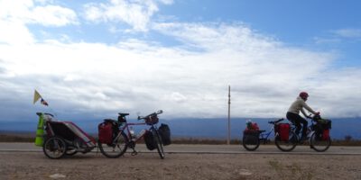
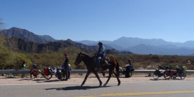
Due to the pandemic we had to postpone our trip, and that has meant we also have to reduce its length. In the end we have decided we will cycle just the South America part, from Colombia southwards. We will miss North America, although culturally it is not as different as Europe, and Central America, but we also avoid the nuisance of the flight between Panama and Colombia.
Our route will change depending on our mood or what we want to see, but basically going south following the Andes. We will probably take public transport here and there, in order to make up for the time we will lose cycling slower or when the route is too challenging for us.
Jonathan
Super cool! Wish you guys a fun and safe trip.
Ricardo
Qué emocionante tiene que ser iniciar un viaje como este.